Wild Atlantic Way Pocket Map: The Perfect Way to Explore Ireland’s West Coast
Synopsis
Explore new places with handy pocket maps from Collins.
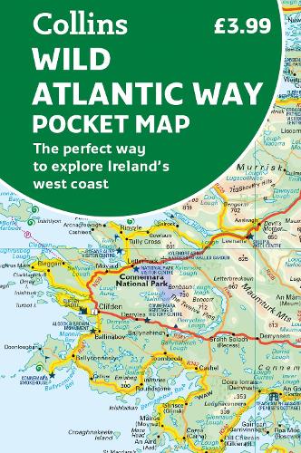
Handy full-colour map of Ireland’s Wild Atlantic Way with a high level of detail. Clear mapping of the full 2500 km (over 1500 miles) route, showing the road network and places of interest.
Clear, detailed Collins road mapping is presented in a handy format ideal for the pocket or handbag. It is excellent value and very detailed for its size, covering the whole of the Wild Atlantic Way.
Ideal for tourists, locals, hikers and adventurers. Places of interest marked, including famous film locations.
This map includes:
• Clear mapping at a scale of 8.7 miles to 1 inch
• National Tourist Routes showing best routes through the most scenic areas
• Places of interest include film locations such as Star Wars
• Tourist and signature locations clearly marked
• Suggested itineraries
• Detailed place names index
• Ideal companion to a sat-nav – it enables route planning and route sense-checking
- Publisher: HarperCollins Publishers
- ISBN: 9780008580001
- Weight: 40g
- Dimensions: 140 x 90 x 5 mm
Customer Reviews
You may also like...