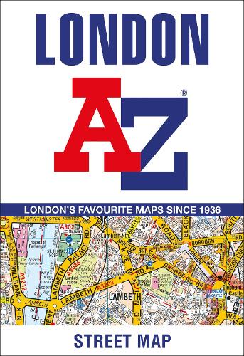
London A-Z Street Map
Map Published on: 02/02/2023
Synopsis
This great value, fold-out map uses our instantly recognisable A-Z street mapping and has handy a TfL Tube map on the back for easy access.
Published at a scale of 3.5 inches to 1 mile, the map extends out from Highbury in the north to Clapham Common and Lewisham in the south, and from Notting Hill and Barnes in the west to Stratford and Greenwich Peninsula, with the O2, in the east.
Postcode districts, one-way streets, the congestion charging zone boundary and safety camera locations with speed limits are all featured on the mapping.
This publication is the perfect choice for those wanting the combination of a desirable map area and a compact folded size.
At just £3.99 this is a high quality, low price map of London.
- Publisher: HarperCollins Publishers
- ISBN: 9780008581787
- Number of pages: 1
- Weight: 80g
- Dimensions: 165 x 113 x 6 mm
Customer Reviews
You may also like...

53.00

13.95


3.99