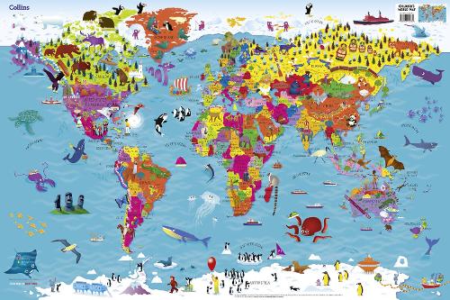
Collins Children's World Map
Map Published on: 23/04/2015
Synopsis
Colourful Illustrated Map of the World
This highly illustrated pictorial map is designed to take children on a journey of discovery around the countries of the world. The mapping is clear, colourful and highly informative and shows countries and capital cities.
Stunning illustrations are used to depict themes such as national emblems, customs, food, birds, animals, buildings and sports to help younger readers gain an understanding of peoples around the world.
Dimensions 610 X 915 mm
Illustrated by Steve Evans.
- Publisher: HarperCollins Publishers
- ISBN: 9780008114732
- Number of pages: 0
- Weight: 40g
- Dimensions: 600 x 900 x 912 mm
Customer Reviews
You may also like...
25.00

13.75
20.00
17.59

11.99
16.99
14.95