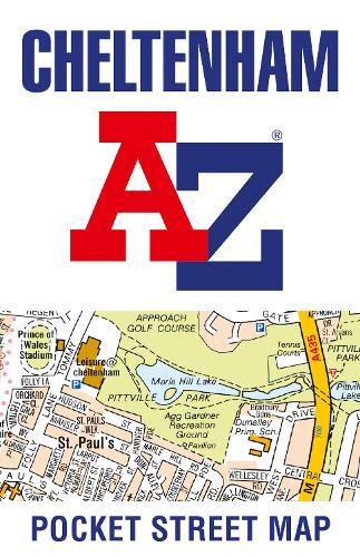
Cheltenham A-Z Pocket Street Map
Map Published on: 15/04/2021
Synopsis
This up-to-date detailed A-Z street map includes more than 2,000 streets in and around Cheltenham.
As well as the Cheltenham Racecourse, the other areas covered include Badgeworth, The Reddings, Up Hatherley, Charlton Kings, Montpellier, Battledown, Hayden, Swindon and Prestbury.
The large-scale street map includes the following:
* Places of interest
* Postcode districts, one-way streets and car parks
* Index to streets, places of interest, place and area names, park and ride sites, national rail stations, hospitals and hospices
The perfect reference map for finding your way around Cheltenham.
- Publisher: HarperCollins Publishers
- ISBN: 9780008445256
- Number of pages: 2
- Weight: 30g
- Dimensions: 140 x 90 x 6 mm
Customer Reviews
You may also like...


53.00


3.99